Creston

HPIM2096.JPG
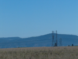
Looking toward northwest of Spokane and the mountains above Spokane River.
HPIM2097.JPG
HPIM2098.JPG
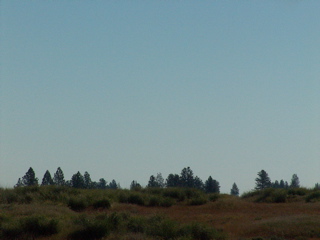
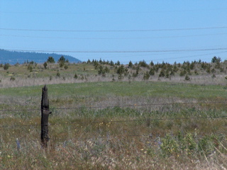
Heading west to Creston. Leaving the pines of Spokane and into the rolling Palouse hills.
HPIM2099.JPG
HPIM2100.JPG
HPIM2101.JPG
HPIM2102.JPG
HPIM2103.JPG
HPIM2104.JPG
HPIM2105.JPG
HPIM2106.JPG
HPIM2107.JPG
Native grasses
HPIM2108.JPG
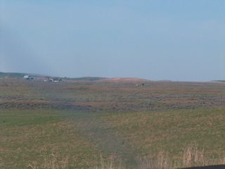
Reardan 15 miles west of Spokane.
HPIM2109.JPG
HPIM2110.JPG
Start of scablands - basalt rock formations with lakes and mostly native plants and animals.
HPIM2111.JPG
HPIM2112.JPG
Aspen grove. All these branches are part of one or a few aspen trees.
HPIM2114.JPG
HPIM2116.JPG
HPIM2117.JPG
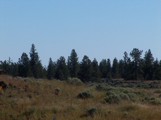
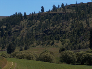
Native sage brush in the rocky land with wheat in the rich fine Palouse soil.
HPIM2118.JPG
HPIM2119.JPG
The mountains above the Spokane river.
HPIM2120.JPG
HPIM2121.JPG
HPIM2122.JPG
HPIM2123.JPG
HPIM2124.JPG
HPIM2125.JPG
HPIM2126.JPG
Sage brush lands of the Scablands. The scablands were created about 12,000 years ago during the great floods that washed away the rich Palouse top soil and carved away some of the basalt rock that gushed out of Earth some 60 million years ago.
HPIM2127.JPG
HPIM2128.JPG
HPIM2129.JPG
HPIM2130.JPG
HPIM2131.JPG
HPIM2132.JPG
HPIM2133.JPG
HPIM2134.JPG
Basalt cliff and lake carved out by the great floods.
HPIM2135.JPG
HPIM2136.JPG
HPIM2137.JPG
HPIM2138.JPG
HPIM2139.JPG
HPIM2140.JPG
HPIM2141.JPG
HPIM2142.JPG
HPIM2143.JPG
HPIM2144.JPG
HPIM2145.JPG
HPIM2146.JPG
Creston's butte.
HPIM2263.JPG
Heading east back to Spokane.
HPIM2264.JPG
HPIM2265.JPG
Slow moving low flying military plane.
HPIM2266.JPG
HPIM2267.JPG
HPIM2269.JPG
HPIM2271.JPG
HPIM2272.JPG
One of the more beautiful willow lined creeks in the region. Most the the willows were poisoned when herbasides were introduced shortly after world war II.
HPIM2273.JPG
HPIM2274.JPG
HPIM2275.JPG
HPIM2276.JPG
HPIM2277.JPG
HPIM2278.JPG
HPIM2279.JPG
HPIM2280.JPG
Deer track.
HPIM2281.JPG
Basalt formation exposed by the great floods.
HPIM2282.JPG
HPIM2283.JPG
HPIM2284.JPG
Flowers that have gone wild from the abandoned farm house.
HPIM2285.JPG
HPIM2286.JPG
HPIM2287.JPG
HPIM2288.JPG
HPIM2289.JPG
HPIM2290.JPG
An ancient willow. Probably one of the bigger willows in the region.
HPIM2291.JPG
HPIM2292.JPG
Layer upon layer of basalt flowed out of the earth and is now the under lying foundation for much of the inland Pacific Northwest.
HPIM2293.JPG
HPIM2294.JPG
HPIM2295.JPG
HPIM2296.JPG
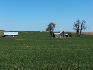
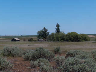
One of the many abandoned farmsteads scattered throughout the region.
HPIM2297.JPG
HPIM2298.JPG
HPIM2299.JPG
HPIM2300.JPG
HPIM2301.JPG
HPIM2302.JPG
HPIM2303.JPG
HPIM2304.JPG
HPIM2305.JPG
HPIM2306.JPG
HPIM2307.JPG
The native flag iris.
HPIM2308.JPG
HPIM2309.JPG
HPIM2310.JPG
HPIM2311.JPG
HPIM2312.JPG
HPIM2313.JPG
HPIM2315.JPG
HPIM2316.JPG
HPIM2317.JPG
HPIM2318.JPG
HPIM2319.JPG
HPIM2320.JPG
HPIM2321.JPG
HPIM2322.JPG
Sage brush. There is a larger variety that gets up to 8 feet of so.
HPIM2323.JPG
Basalt stone from the Rosa (Red) Formation
HPIM2324.JPG
HPIM2325.JPG
HPIM2326.JPG
One of the many LBBs of the region - Little Brown Birds. Not to be confused with LBM. Little Brown Mushrooms.
HPIM2327.JPG
HPIM2328.JPG
HPIM2329.JPG
HPIM2330.JPG
HPIM2331.JPG
HPIM2333.JPG
HPIM2337.JPG
HPIM2338.JPG
HPIM2341.JPG
Pillow style basalt formation. There are many styles of basalt formations. Crystal formations are a more common form near Spokane. When the hot liquid lava rock cooled various styles of basalt formations were created depending on the chemical characteristics and other factors.
HPIM2342.JPG
HPIM2344.JPG
HPIM2345.JPG
HPIM2147.JPG
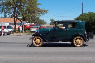
The town of Creston between Davenport and Wilbur.
HPIM2148.JPG
HPIM2149.JPG
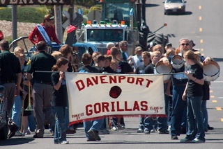
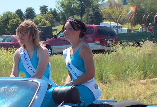
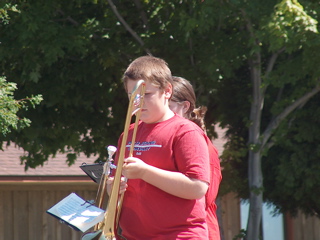
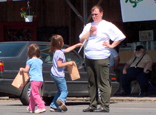
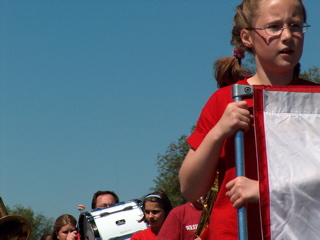
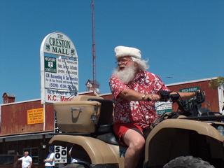
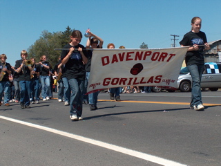
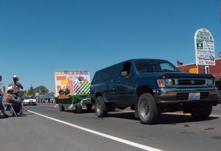
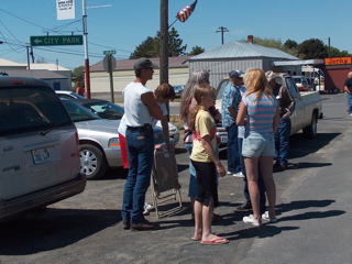
Creston Parade. Getting reading to rock and roll.
HPIM2150.JPG
HPIM2152.JPG
HPIM2153.JPG
HPIM2154.JPG
HPIM2155.JPG
HPIM2156.JPG
HPIM2157.JPG
HPIM2158.JPG
HPIM2159.JPG
HPIM2160.JPG
HPIM2161.JPG
HPIM2162.JPG
HPIM2163.JPG
HPIM2164.JPG
HPIM2165.JPG
HPIM2166.JPG
HPIM2167.JPG
HPIM2168.JPG
HPIM2169.JPG
HPIM2170.JPG
HPIM2171.JPG
HPIM2172.JPG
HPIM2173.JPG
HPIM2174.JPG
HPIM2175.JPG
HPIM2176.JPG
HPIM2177.JPG
HPIM2178.JPG
HPIM2179.JPG
HPIM2180.JPG
HPIM2181.JPG
HPIM2182.JPG
HPIM2183.JPG
HPIM2184.JPG
HPIM2185.JPG
HPIM2186.JPG
HPIM2187.JPG
HPIM2188.JPG
HPIM2189.JPG
HPIM2190.JPG
HPIM2191.JPG
HPIM2192.JPG
HPIM2193.JPG
HPIM2194.JPG
HPIM2195.JPG
HPIM2196.JPG
HPIM2197.JPG
HPIM2198.JPG
HPIM2199.JPG
HPIM2200.JPG
HPIM2201.JPG
HPIM2202.JPG
HPIM2203.JPG
HPIM2204.JPG
HPIM2205.JPG
HPIM2206.JPG
HPIM2207.JPG
HPIM2208.JPG
HPIM2209.JPG
HPIM2210.JPG
HPIM2211.JPG
HPIM2212.JPG
HPIM2213.JPG
HPIM2214.JPG
HPIM2215.JPG
HPIM2216.JPG
HPIM2217.JPG
HPIM2218.JPG
HPIM2219.JPG
HPIM2220.JPG
HPIM2221.JPG
HPIM2222.JPG
HPIM2223.JPG
HPIM2224.JPG
HPIM2225.JPG
HPIM2226.JPG
HPIM2227.JPG
HPIM2228.JPG
HPIM2229.JPG
HPIM2230.JPG
HPIM2231.JPG
HPIM2232.JPG
HPIM2233.JPG
HPIM2234.JPG
HPIM2235.JPG
HPIM2236.JPG
HPIM2237.JPG
HPIM2238.JPG
HPIM2239.JPG
HPIM2240.JPG
HPIM2241.JPG
HPIM2242.JPG copy
HPIM2242.JPG
HPIM2243.JPG
HPIM2244.JPG copy
HPIM2244.JPG
HPIM2245.JPG
HPIM2246.JPG
HPIM2247.JPG
HPIM2248.JPG
Note the Canadian and USA flag on the Conern Cafe. There is pleny of business from Canadians. Many places accept Canadian dollars at par with USA dollars - a good bargin for Candian money.
HPIM2249.JPG
HPIM2250.JPG
HPIM2251
HPIM2252.JPG
HPIM2253.JPG
HPIM2254.JPG
HPIM2255.JPG
HPIM2256.JPG
HPIM2257.JPG
HPIM2258.JPG
HPIM2259.JPG
HPIM2260.JPG
HPIM2262.JPG
Note the Canadian flag along with the USA flag. There has always been plenty of traffic between the northern parts of the USA and southern parts of Canada just like the between the southern parts of the USA and northern Mexico. Lots of families and friends and vactioneers go back and forth on a regular basis depending on the exchange rate.